Hi all! This topic is veeery specific to a Norwegian map service, so I feel like it’s a long shot - but who knows.
ATM, I’ve fallen down the topo-rabbit hole. The Norwegian map authorities has a service to export lidar height data down to 0.5m/1m resolution. The thing is, they limit export size to 4x4km! If I export a larger area, the geotiffs comes in tiles, and it’s difficult to stitch them, because each tile has it’s own height scale. I’ve tried to screen capture a “heat colored map” of the height live from the map, but its difficult to convert to 3d data.
Has anyone had similar issues, either with Kartverket, or other similar services? How did you solve it?
A little update from the rabbit hole. I’ve dug a little deeper, and found a possible approach: the map authorities offer pre-produced height data, that comes in bundles. I don’t know how they are organized, if they are in tiles as well. The thing is - the packages are from 10gb to 200gb. 1m packages are huuuge, perhaps 10m is a decent compromise.
I was an intern at an environmental engineering company. They had full time engineers that pretty much only worked on GIS. It is definitely not as simple as it looks. And they are very data intensive.
Have you done any calculations to figure out what resolution you can use? I wonder what the size of your bit would be if you make even a 1m model of Norway.
I hope you get somewhere with it. That sounds like a fun project.
Thanks for your input - as always Jeff! Indeed GIS is not as simple as it seems… but I feel like I’ve broken a few barriers now. I’m still not able to get larger datasets than 4x4km, but I’m not sure if it’s necessary for bigger landscapes, the amount of data would be staggering and unnecessary for a print or milling. Now that I’ve starten to get my head around things, I think I’ll manage different data sources as well, and should be comfortable comparing them to each other. QGIS is neat when you figure a few things out.
Well - I haven’t gotten to any hard materials yet - but here is my northpole suburbian neighborhood: https://askevold.net/hjem/
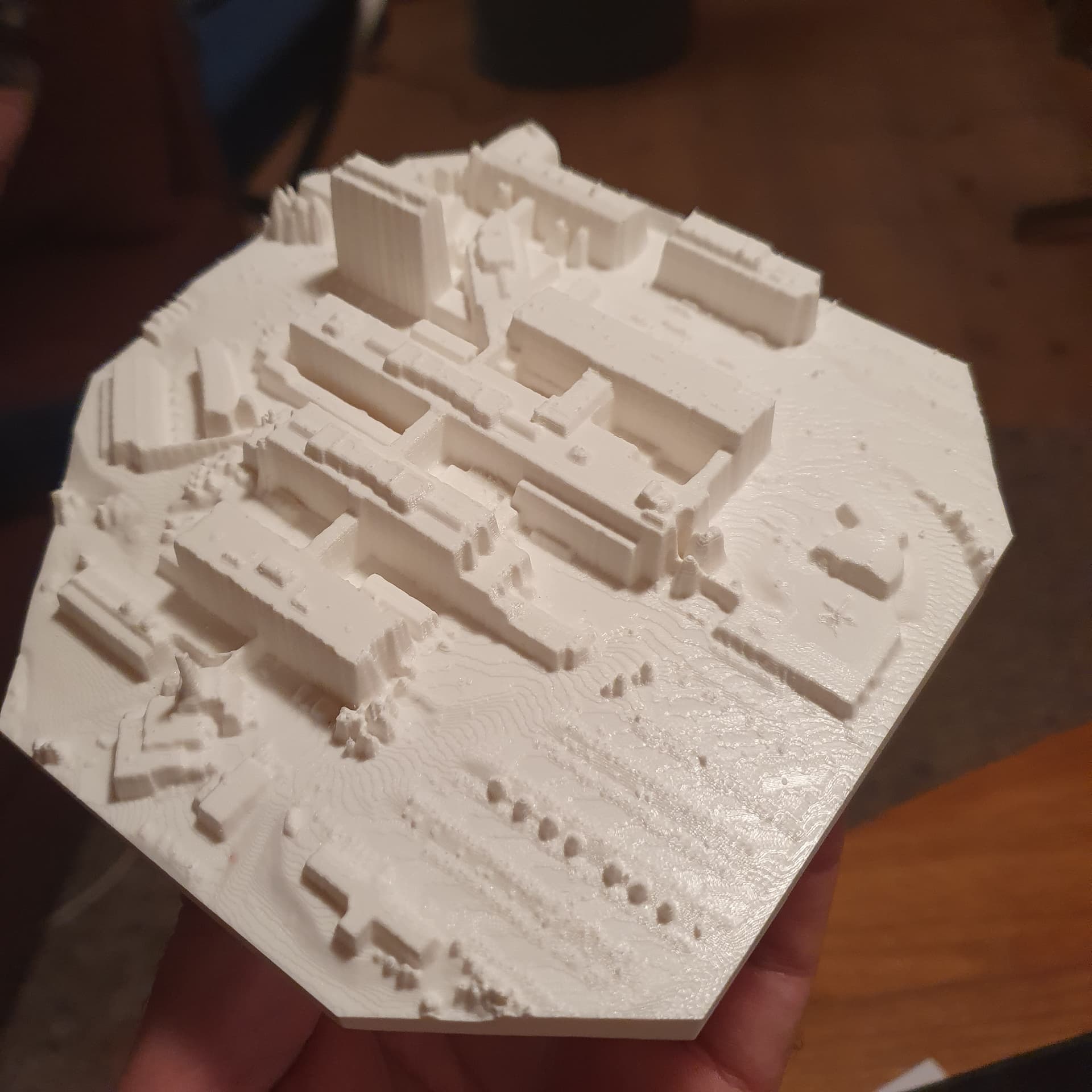
A physical map of work. To make it easier for newcomers to find their way around in the maze corridors.
I wrote to the map authorities. They replied! Almost as friendly as you guys. There’s actually a way to stream the map data directly into the GIS software, to circumvent export delay and tile size limit. (WMS) I guess I have to keep an eye on ram and bandwidth usage, wouldn’t want the whole set downloaded in the background… The complete dataset for 10m resolution is 100GB. I don’t dare to imagine how big the 0.5-1m resolution data size is…
Touchterrain from Iowa State Univ. seems to have the easiest interface for getting map data into STL models. They have one dataset with 30m resolution worldwide. (And a 10m one in the US).
With Manual Settings, you can drop the height of the ocean to accentuate coastlines or allow a resin-filled ocean like my last project.